Precision Mapping Expertise
Advanced Drone Solutions
Marine Inspection Solutions
Fast Turnaround
time
Precision at Every Scale
Experience the difference with Tailored Spatial Solutions, the trusted
name for GIS solutions in Cairns and Far North Queensland.
Our comprehensive range of services includes mapping, inspections, thermal imaging, underwater robotic inspections, pipe crawler inspections, and Terrestrial 3D scanning.
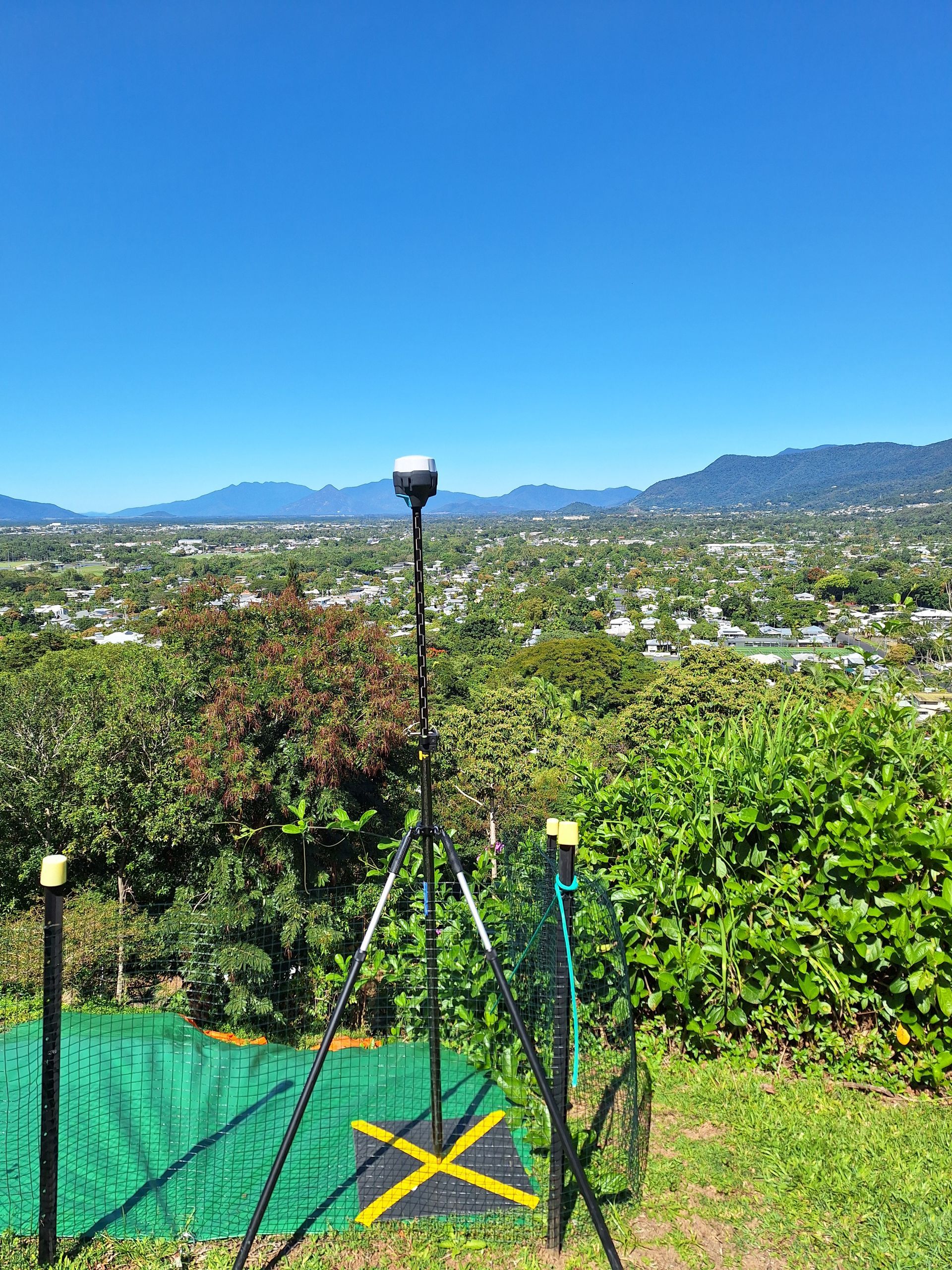
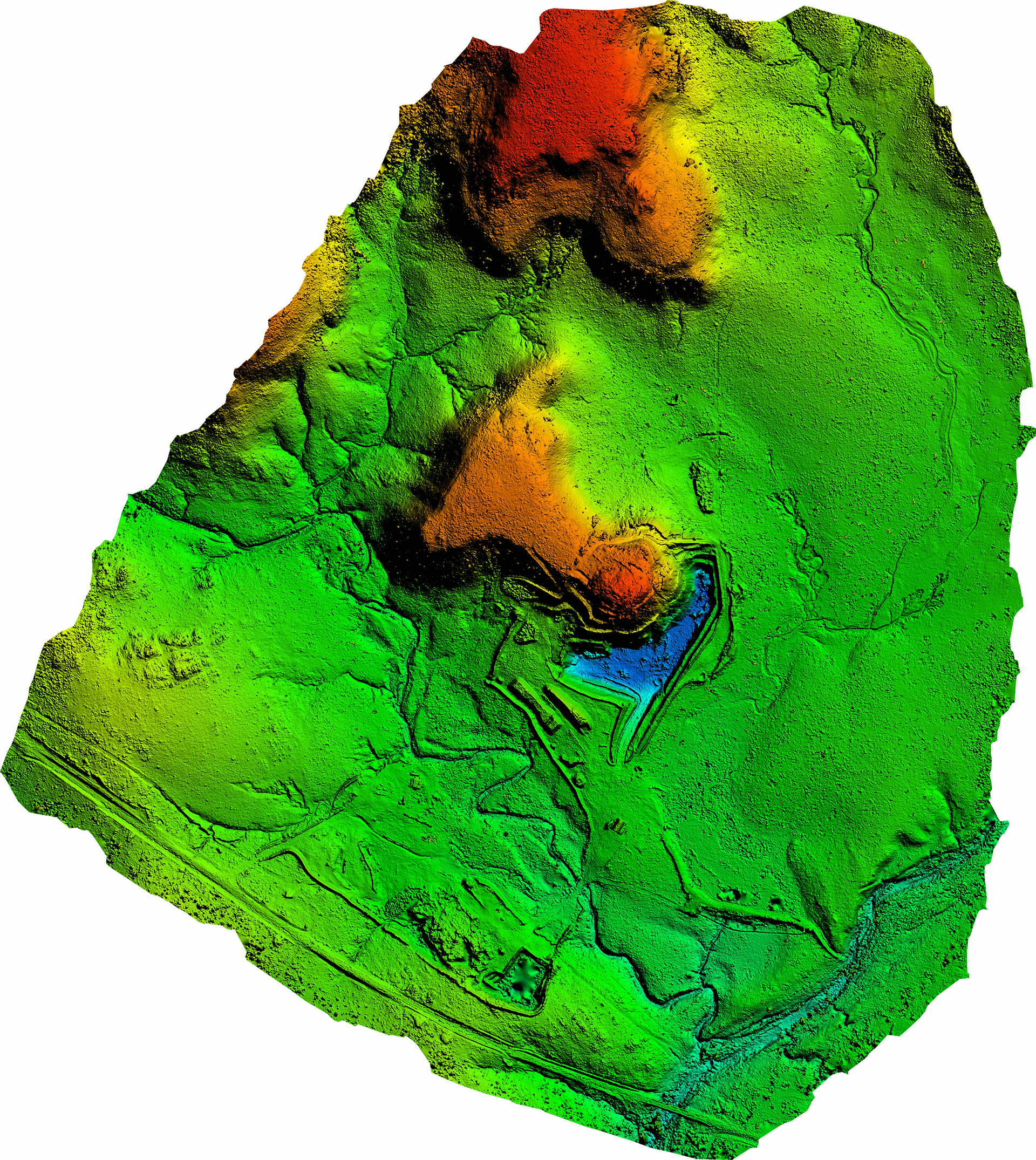
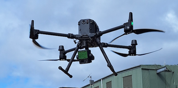
We leverage cutting-edge drone technology alongside LIDAR and photogrammetry to deliver high-precision mapping and surveying solutions. Our drones provide fast, efficient, and cost-effective aerial data collection, ensuring accuracy across large and inaccessible areas.
Our team excels in detailed inspections, using drones for high-resolution imaging and advanced thermal scanning for building assessments and solar panel efficiency checks.
With state-of-the-art underwater robotic technology, we inspect submerged structures with unparalleled accuracy, while our specialised pipe crawler equipment ensures thorough evaluations with minimal disruption.
Our terrestrial 3D scanning services, combined with drone-captured data, provide accurate digital models for planning, design, and asset management.
Call us today on (07) 4035 6510 to discuss how we can assist with your next project.
Request a Call Back
What We Do
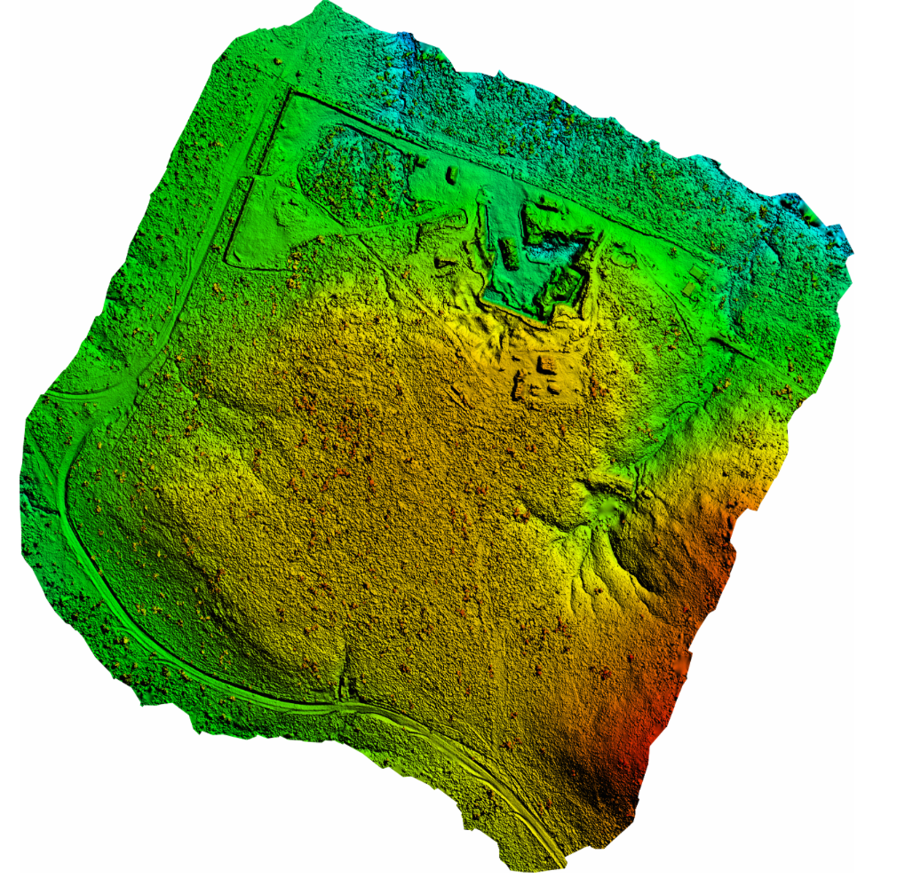
Providing precise mapping services using advanced LIDAR and photogrammetry technology. Supporting infrastructure development, environmental assessments, and construction planning with accurate spatial data to streamline decision-making and deliver exceptional results.
Comprehensive inspection services include structural, thermal, and robotic assessments. Advanced techniques ensure safety, compliance, and operational efficiency, delivering detailed insights for maintenance, repairs, or upgrades across diverse industries.

Thermal imaging services use advanced technology to detect heat anomalies, support search and rescue missions, and evaluate equipment and solar installations, ensuring optimal performance and safety in critical applications.
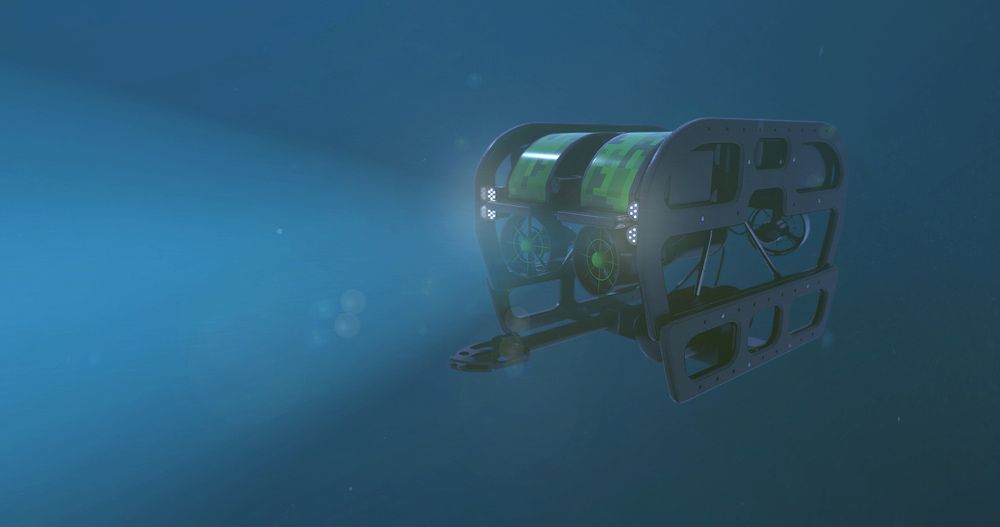
Robotic systems provide accurate underwater inspections for submerged structures, pipelines, and marine environments. Advanced technology delivers detailed assessments, ensuring safety, operational efficiency, and maintenance support without disruption.
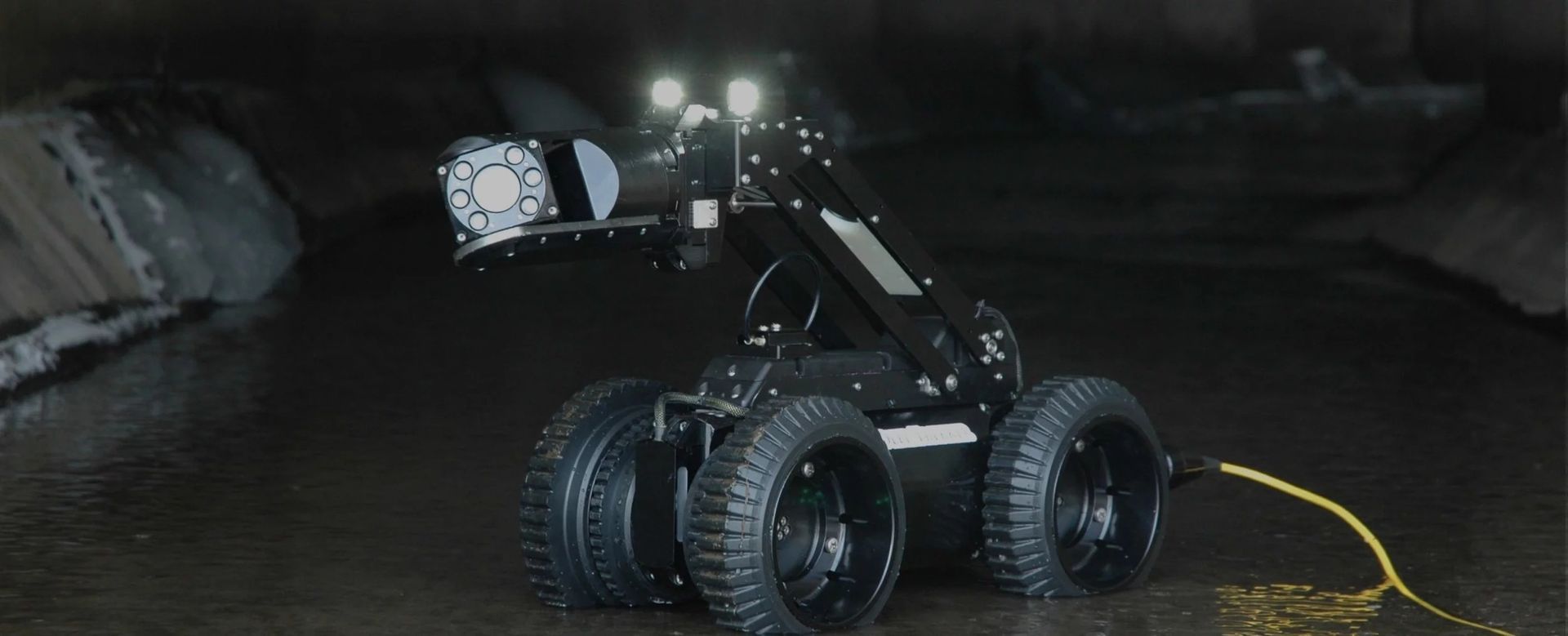
Advanced pipe crawler inspections ensure accurate assessments of underground pipelines, identifying blockages, faults, and structural issues. Non-invasive technology supports efficient maintenance, repairs, and operational planning.
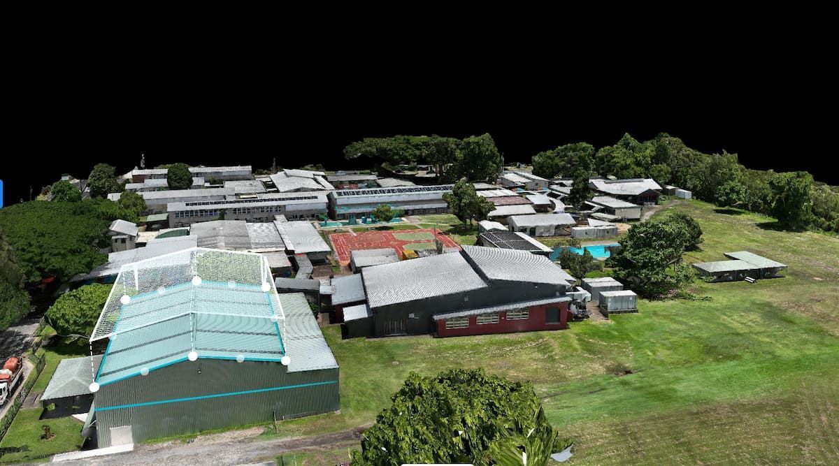
Detailed 3D scanning creates accurate digital models for planning, design, and documentation. High-resolution scanning supports architectural, construction, and interior projects with precision and efficiency.
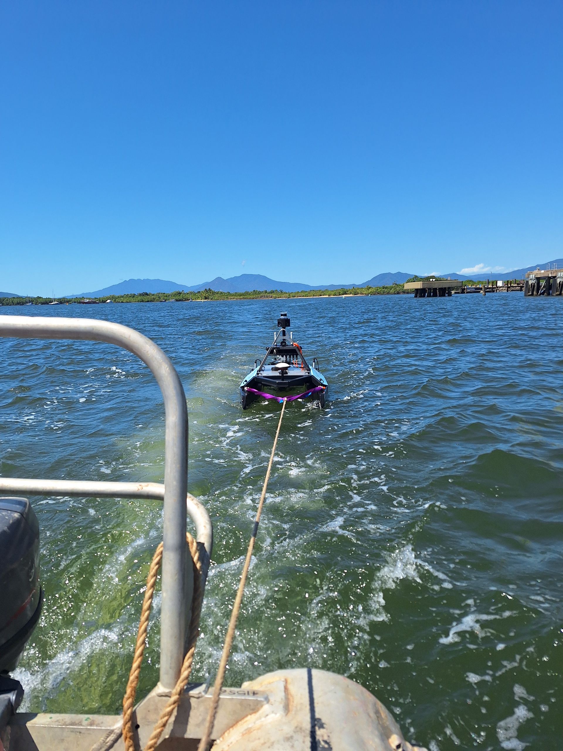
Need underwater data you can trust? Our hydrographic surveys use multibeam, single beam and side scan sonar to map depths, detect objects and support marine planning. It's a fast, accurate way to get the info you need below the surface.
Your trusted partner in innovative spatial solutions
Excellence in Every Detail
Delve deeper into the many exceptional services we offer and discover our relentless pursuit of excellence.
Our team goes beyond standard practices to ensure every client benefits from:
- Advanced drone-enabled LIDAR and photogrammetry technology for accurate, large-scale mapping.
- Specialised drone and ground-based equipment for comprehensive and non-invasive inspections.
- Quick turnaround times and detailed reporting, with drone-captured data enhancing decision-making.
- A team of professionals with expertise in sophisticated drone mapping and inspection techniques.
For more information or to request a quote, get in touch with our experienced team today.
Together, we’ll chart the path to your project’s success with precision, efficiency.