Spatial Solutions in Cairns
Precision Mapping Expertise
Advanced Inspection Solutions
Fast Turnaround Times
Innovative Technology Leadership
Cutting-Edge Precision Delivered
At Tailored Spatial Solutions, we provide high-precision drone and spatial solutions in Cairns and North Queensland for industries including construction, engineering, mining, and environmental management. Using cutting-edge technology such as drones, LIDAR, and photogrammetry, we capture detailed spatial data, transforming the way businesses manage projects and infrastructure. Our drone mapping solutions offer elevation models, 3D digital twins, and contour mapping, delivering critical insights for large-scale developments, asset management, and environmental monitoring.
Our expertise includes detailed asset inspections, ensuring the safety, efficiency, and longevity of infrastructure. We use drones to conduct roof inspections, thermal imaging, and stockpile measurements, helping businesses optimise planning, detect structural issues, and improve resource allocation. Drone-based construction progress tracking, site rehabilitation monitoring, and digital modelling further enhance project management, reducing costly delays and inefficiencies.
By combining advanced data capture methods, including drone technology, with real-time insights, we provide businesses with the tools to make informed decisions, streamline workflows, and enhance operational efficiency. Whether tracking construction progress, monitoring environmental changes, or assessing complex infrastructure, we deliver accurate, cost-effective solutions.
Call us on (07) 4035 6510 to see how we can support your project with mapping, inspections, thermal analysis, underwater robotic and pipe crawler inspections, and Terrestrial 3D scanning.
The Blueprint to Project Success
Our drone surveying and inspection services improve efficiency, accuracy, and safety, helping businesses make informed decisions with confidence. We offer:
- High-Precision Drone Mapping – Capturing accurate elevation models, contour data, and site surveys for land development, construction, and engineering projects using drone-based LIDAR and photogrammetry.
- Drone-Captured Digital Twin Technology – Creating 3D replicas for remote monitoring, asset management, and infrastructure planning.
- Drone Asset & Structural Inspections – Assessing bridges, towers, roofs, and industrial infrastructure without manual access or shutdowns.
- Thermal Imaging with Drones – Detecting inefficiencies in solar farms, power networks, and insulation using advanced drone-mounted thermal cameras, preventing costly failures.
- Drone Stockpile & Volume Measurements – Conducting precise material tracking for mining, quarrying, and construction inventory management.
- Construction Progress Tracking via Drones – Using aerial drone mapping to monitor project timelines, identify issues early, and ensure smooth execution.
- Environmental & Land Monitoring – Analysing terrain changes, land rehabilitation, and conservation efforts with highly detailed drone imaging.
- Live Drone Inspection Views & Telemetry Overlay – Providing real-time drone feeds with precise data overlays, enabling immediate on-site decision-making.
- Cost-Effective & Safe Drone Solutions – Reducing the need for expensive manual surveys while improving worker safety and minimising project delays.
Call us today on (07) 4035 6510 to learn how our solutions can support your project.
Your trusted partner in innovative spatial solutions.
LIDAR & Photogrammetry
At Tailored Spatial Solutions, we use LIDAR and photogrammetry to capture highly accurate spatial data for a range of industries. These advanced capture methods provide detailed insights for planning, monitoring, and analysis.
Our services include:
- Elevation Models (DTM & DSM) – Generating precise digital terrain and surface models for land analysis and development.
- Landslide Surveying – Assessing slope stability and monitoring geological changes to prevent risks.
- High-Density Point Clouds – Creating detailed 3D representations of landscapes, infrastructure, and assets.
- Contour Mapping – Producing accurate topographic maps for construction, engineering, and environmental planning.
- 3D Digital Twins of Assets – Developing virtual models for infrastructure, buildings, and industrial sites.
- High-Quality Orthophotos – Delivering georeferenced aerial images for accurate mapping and analysis.
- Ongoing Construction Progress Reporting – Tracking site development with real-time, high-resolution imaging.
- Environmental Mapping – Providing detailed data for land management, conservation, and ecological studies.
- Mine & Quarry Surveying – Capturing precise measurements for excavation planning and compliance.
- Mine & Quarry Stockpile Measurements – Accurately assessing material volumes for inventory management.
- Mine & Quarry Site Rehabilitation – Monitoring land restoration efforts with high-precision spatial data.
Using industry-leading LIDAR and photogrammetry technology, we deliver actionable insights to support informed decision-making.
Our Mapping Projects
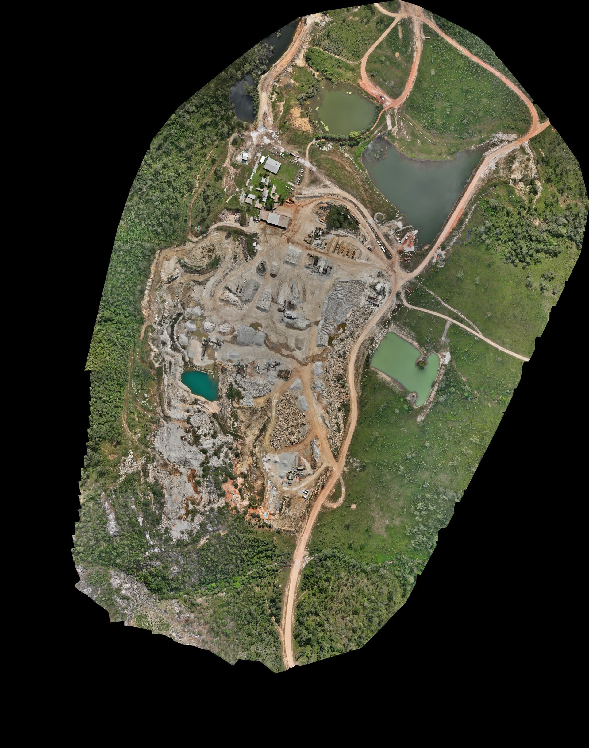
Tailored Spatial Solutions has demonstrated expertise in various drone surveying techniques, including LiDAR and photogrammetry surveys to produce detailed surface data and imagery. Discover some of our work:
- Barron Gorge Hydroelectric Power Station: We conducted a LiDAR and photogrammetry survey of Barron Gorge Hydroelectric Plant and Barron Dam, producing detailed surface data and imagery despite dense rainforest canopy and elevation changes, to identify rock formations for Clean Co Queensland.
- Arnhem Space Centre: Tailored Spatial Solutions collaborated with Measure Australia and ELA Space to capture promo photos and photogrammetry of Arnhem Space Centre, processing over 4000 images to colourise a LiDAR point cloud and create a high-quality orthomosaic image of the 750-hectare site.
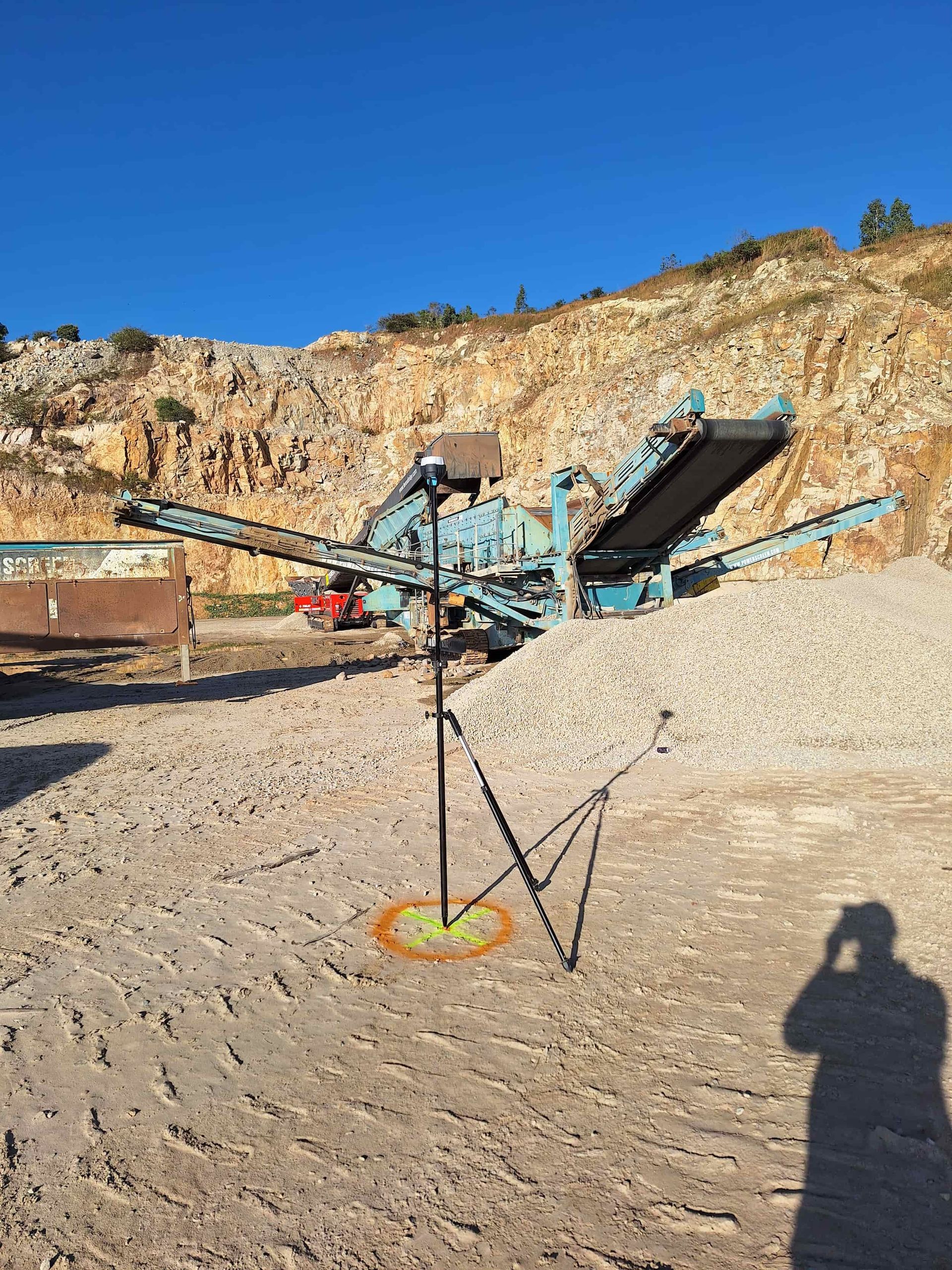
- Boral Redlynch and Tichum Creek Mine: We deployed a photogrammetry drone and captured ground control points at both Boral sites. The purpose of the photogrammetry survey was to capture a current up to date high quality orthomosaic image for compliance monitoring.
- Barron Dam - Post Cyclone Jaspar: We have been conducting ongoing surveys of the Barron Dam for Clean Co Queensland to obtain ground levels and provide high quality orthophoto of the site so they can make plans and make decisions regarding ongoing repairs. We have conducted 6 surveys since December 2024.
- Nolans Quarry Crossing: We conducted a photogrammetry survey so that an orthophoto and digital surface model could be created for Groundwork Plus. This allowed them to create updated plans and make blasting plans for the site.
- Gingeralla Quarry: We conducted a photogrammetry survey so that an orthophoto and digital surface model could be created for Groundwork Plus. This allowed them to create updated plans and make blasting plans for the site
- Archer River Quarry 2024: Our team surveyed three sites across the quarry, checking to ensure that operations have remained within the required boundaries. We also gathered information and data to assist the client with their application to increase the quarry’s boundaries, allowing for them to mine more areas.
- Historical Building 3D Model of Julia Creek Hotel: Due to damage beyond repair, a historical pub had to be demolished. Working with architects and heritage specialists, we were tasked with creating a 3D model of the exterior and interior of the building, utilising photogrammetry and a Matterport camera to preserve the building's history.
- Landslide Surveys: Since Cyclone Jasper, we have conducted over 20 landslide surveys between Cairns and Cape Tribulation for engineers, surveyors and insurance companies. This helped facilitate the recovery of the Far North QLD region.
OFFICE Hours
- Monday
- -
- Tuesday
- -
- Wednesday
- -
- Thursday
- -
- Friday
- -
- Saturday
- -
- Sunday
- -
EMERGENCY CALL-OUTS AVAILABLE
LicenCes
CASA ReOC: 9043
ACN: 668 872 071
AAUS Membership


